Publishing History > A Short History of the World's Greatest Atlases
A Short History of the World's Greatest Atlases
For centuries atlases were magnificent works, as much artworks as scientific tools. Some of the greatest atlases, published in the 16th, 17th and 18th centuries, still have the power to astonish us.
So... What Exactly is an Atlas?
An atlas is a collection of maps, normally bound together into book form.
Most atlases feature maps of the earth or a region of the earth. The majority of atlases feature geographical (or physical) information and political boundaries; some feature social, historical or economical statistical information.
The earliest modern atlas dates from 1570. Its publication marked the beginning of the golden age of atlases -- immense and magnificent books, produced for the palaces and homes of the wealthy. These atlases produced in the period through to 1800 by such cartographers as Ortellius and Blaeu are truly spectacular art works as much as scientific and geographical references.
With the arrival of the Internet, some atlases are now published online.
Theatrum Orbis Terrarum ("Theater of the World") (1570)
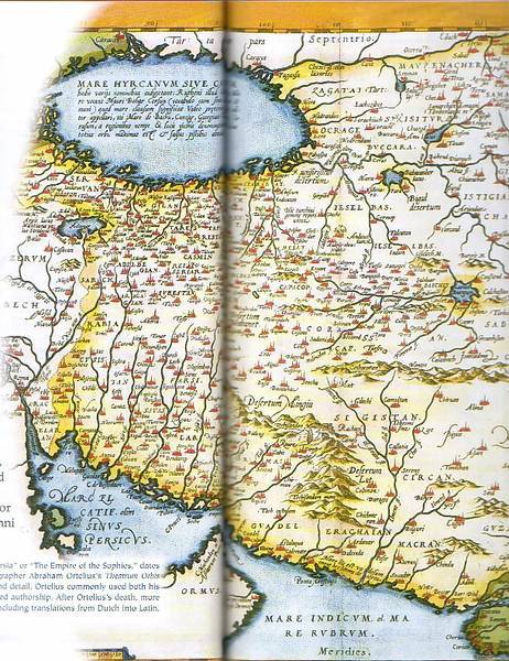
Figure 1: Map of the Persian Empire, from theTheatrum Orbis Terrarum by Abraham Ortelius (1570)
Created by Abraham Ortelius in Antwerp, Netherlands, the Theatrum Orbis Terrarum ("Theater of the World"), with 70 maps and supporting text, this work (first published in 1570) is regarded as the "first modern atlas". It is based on the work of other mapmakers, whose works have since been lost, and is regarded as a summary of 16th century cartography.
Atlas Novus ("New Atlas"); Atlas Maior ("Great Atlas") (1635-65)
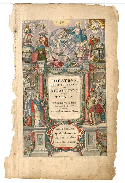
Figure 2: Title page of Theatrum Orbis Terrarum, sive Atlas Novus... by Willem and Joan Blaeu (1645)
A comprehensive world atlas was planned by Willem Blaeu, of Amsterdam, Netherlands, and published in 1635 by his son Joan Blaeu.
This atlas was the Atlas Novus ("New Atlas"). The full title was: Theatrum Orbis Terrarum, sive Atlas Novus in quo Tabulae et Descriptiones Omnium Regionum ("Theater of the World, or a New Atlas of Maps and Representations of All Regions"). It included maps of Europe, Africa, Asia, America and the Arctic, and was published in two volumes.
Later editions (from 1662) were titled the Atlas Maior ("Great Atlas"), comprising 594 maps with 3,000 of supporting Latin text in eleven volumes. The atlas was translated from Latin into Dutch, English, German, French and Spanish.
The pages of the Atlas Maior featured beautiful, highly decorated engraving. They became highly sought after purchases by the rich and powerful. To this day the Atlas Maior remains one of the masterworks of mapmaking.
The New and Correct English Atlas (1787-1844)
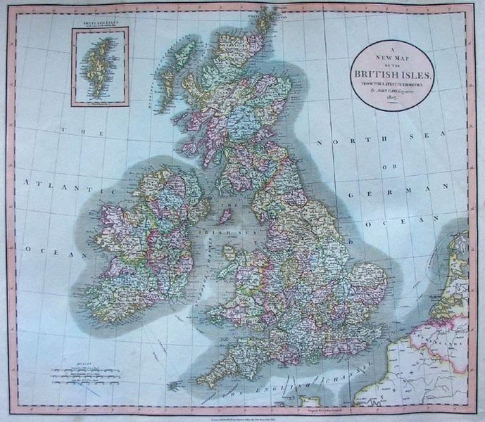
Figure 3: The New and Correct English Atlas by John Cary (first published 1787)
The New and Correct English Atlas was first published by English cartographer, John Cary, in 1787.
This new atlas had much less ornament and decoration than earlier atlases such as those described above. However, its maps were noted for the clarity, accuracy and final detail of its etchings. This reflected the needs of the new market for maps and atlases in Cary's time: the rising middle class who needed information to help them conduct their business and travel the country.
This atlas became a standard reference work in Britain for many years, with the final edition appearing in 1862. It was followed by the very popular Cary’s New Universal Atlas, first published in 1811 and issued in new editions until 1844.
Stielers Handatlas (1817-1944)
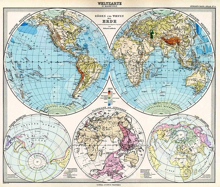
Figure 4: Map of the world in hemispheres in Stielers Handatlas (1891)
Stielers Handatlas, or Hand-Atlas über alle Theile der Erde und über das Weltgebäude ("Handy Atlas of All Parts of the World and of the Universe"), was a German atlas in print for well over a century.
From the 7th edition (1871-75) onwards, this atlas was renowned for its high level of scientific accuracy and its relief work. The 10th edition (1920-25) had a index with 320,000 entries and was the world's comprehensive atlas of its time.
Stielers Handatlas also came out in English, French, Italian and Spanish editions.
Historical Atlases on the Internet
Ortelius Atlas
Current Atlases on the Internet
National Geographic maps
Further Reading
Books
Allen, P. The Atlas of Atlases. London, Ebury Press, 1992.
Moreland, C. & Bannister, D. Antique Maps. London, Phaidon Christies, 1989.
Tooley, R. V. Maps and Map-Makers. London, Batsford, 1987
Articles
Map Forum - Online articles from Map Forum magazine
Websites
Atlases (Library of Congress)
Cartographers (Map Makers)
Dictionary of Cartographers and Mapmakers
Globe
Share this page:
Author: David Paul Wagner
(David Paul Wagner on Google+)
|